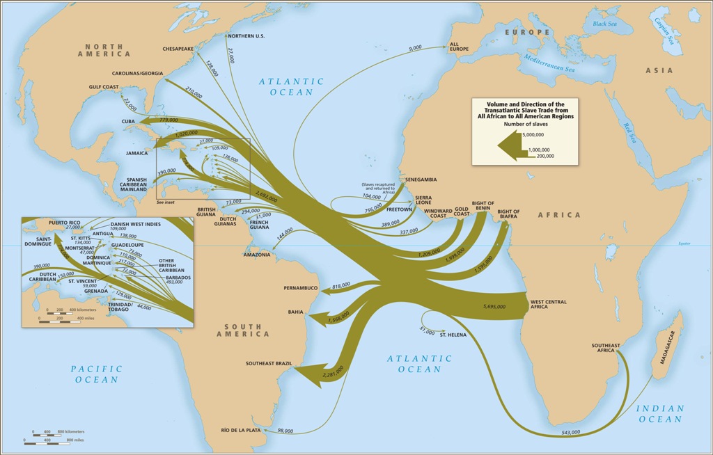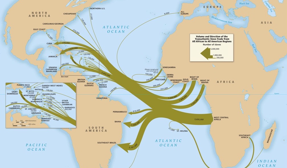
This map summarizes and combines the many different paths by which captives left Africa and reached the Americas. While there were strong connections between particular embarkation and disembarkation regions, it was also the case that captives from any of the major regions of Africa could disembark in almost any of the major regions of the Americas. Even captives leaving Southeast Africa, the region most remote from the Americas, could disembark in mainland North America, as well as the Caribbean and South America. The data in this map are based on estimates of the total slave trade rather than documented departures and arrivals.